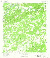
1964 Map of Wimberley
USGS Topo · Published 1968About this map
The Blanco River snakes across the northern landscape of this Central Texas survey, defining the valley where Wimberley serves as the primary hub. Upstream from the town, the river is flanked by Pioneer Town and recreational sites like the Houston Boys Camp, reflecting the area's mid-century role as a retreat and ranching center. The rugged terrain to the south is marked by numerous dry creek beds and draws, including Sink Creek and Purgatory Creek, which carve deep contours into the limestone hills.
Find a feature on this map
31 named features on this map. Tap any name to fly to it.
Don’t see what you’re looking for? This feature index may not catch every label — zoom into the map to look around manually.
Map Details
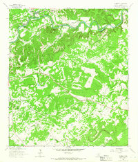
Editions of this 1964 Wimberley Map
2 editions found
Other maps of this area

1887 · Blanco
USGS Topo · 1:125,000

1894 · Blanco
USGS Topo · 1:125,000

1896 · Austin
USGS Topo · 1:125,000

1897 · Austin
USGS Topo · 1:125,000

1910 · Austin
USGS Topo · 1:125,000

1911 · San Marcos
USGS Topo · 1:125,000

1919 · San Marcos
USGS Topo · 1:125,000

1925 · Hunter No 3
USGS Topo · 1:48,000

1929 · Hunter
USGS Topo · 1:62,500

1953 · Seguin
USGS Topo · 1:250,000