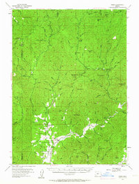
1954 Map of Wimer
USGS Topo · Published 1963About this map
Wimer and the surrounding Evans Valley School district anchor this 1950s study of the southern Oregon highlands where Jackson Co meets Josephine Co. The settlement pattern follows the fertile bottomlands of Pleasant Valley and the winding course of Pleasant Creek, while the higher elevations are dominated by the Umpqua National Forest. The map documents a landscape defined by its drainages and resource management, featuring the Pleasant Creek Guard Station and the remote Salt Creek Guard Station.
Find a feature on this map
91 named features on this map. Tap any name to fly to it.
Don’t see what you’re looking for? This feature index may not catch every label — zoom into the map to look around manually.
Map Details
Editions of this 1954 Wimer Map
3 editions found

Other maps of this area

1891 · Ashland
USGS Topo · 1:250,000

1893 · Ashland
USGS Topo · 1:250,000

1897 · Ashland
USGS Topo · 1:250,000

1904 · Riddle
USGS Topo · 1:125,000

1908 · Grants Pass
USGS Topo · 1:125,000

1938 · Medford
USGS Topo · 1:125,000

1943 · Trail
USGS Topo · 1:62,500

1944 · Tiller
USGS Topo · 1:62,500

1954 · Medford
USGS Topo · 1:62,500

1954 · Days Creek
USGS Topo · 1:62,500