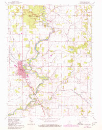
1962 Map of Winamac
USGS Topo · Published 1980About this map
The Tippecanoe River meanders through the heart of Pulaski County, serving as the central geographic feature for the surrounding prairie and woodland. In the town of Winamac, the local hub is defined by the Courthouse and a grid of streets including Main St and Washington St, bordered by the Conrail line. To the north, the Tippecanoe River State Park and Winamac State Fish and Wildlife Area preserve large tracts of natural landscape, including a Lookout Tower and Park Headquarters.
Find a feature on this map
60 named features on this map. Tap any name to fly to it.
Don’t see what you’re looking for? This feature index may not catch every label — zoom into the map to look around manually.
Map Details
Editions of this 1962 Winamac Map
2 editions found
Other maps of this area

1953 · Chicago
USGS Topo · 1:250,000

1953 · Danville
USGS Topo · 1:250,000

1955 · Danville
USGS Topo · 1:250,000

1956 · Danville
USGS Topo · 1:250,000

1957 · Chicago
USGS Topo · 1:250,000

1960 · Grass Creek
USGS Topo · 1:24,000

1962 · Buffalo
USGS Topo · 1:24,000

1962 · Winamac
USGS Topo · 1:24,000

1962 · Star City
USGS Topo · 1:24,000

1962 · Kewanna
USGS Topo · 1:24,000