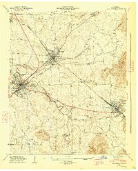
1947 Map of Winchester
USGS Topo · Published 1948About this map
Winchester and its neighboring towns of Decherd and Cowan anchor this mid-century landscape where industrial infrastructure meets the base of the Cumberland Plateau. The rail-centric economy of the era is evident in the sprawling corridor of the Nashville Chattanooga and St Louis line, which serves as a vital artery through the county. Notable local landmarks like the County Fairgrounds and the Sewage Disposal Plant reflect the post-war municipal growth of the region.
Find a feature on this map
65 named features on this map. Tap any name to fly to it.
Don’t see what you’re looking for? This feature index may not catch every label — zoom into the map to look around manually.
Map Details
Editions of this 1947 Winchester Map
3 editions found
Other maps of this area

1895 · Sewanee
USGS Topo · 1:125,000

1928 · Decherd
USGS Topo · 1:62,500

1936 · Sewanee
USGS Topo · 1:24,000

1936 · Alto
USGS Topo · 1:24,000

1936 · Sinking Cove
USGS Topo · 1:24,000

1936 · Beans Creek
USGS Topo · 1:24,000

1936 · Winchester
USGS Topo · 1:24,000

1936 · Belvidere
USGS Topo · 1:24,000

1936 · Pitcher Ridge
USGS Topo · 1:24,000

1936 · Camp Peay
USGS Topo · 1:24,000