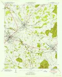
1947 Map of Winchester
USGS Topo · Published 1963About this map
Winchester and Decherd serve as the primary hubs of this Franklin County landscape, connected by the heavy traffic of the Nashville Chattanooga and St Louis railway. The topography is defined by the winding course of Boiling Fork Creek and the distinctive elevations of Little Mtn and Little Mountain. This mid-century survey reveals a dense network of rural community landmarks, including numerous family-named burial grounds like Mt Garner Cem and Darwin Cem, alongside institutional anchors such as the County Fairgrounds. The presence of the Cedar Bluff Mill and the Sewage Disposal Plant illustrates the area's transition between agricultural roots and mid-century municipal infrastructure. Smaller settlements like Cowan, Goshen, and Asia are documented with their associated local schools and churches, including Owen Chapel Ch and the Penile Sch, providing a detailed look at the social geography of the era.
Find a feature on this map
48 named features on this map. Tap any name to fly to it.
Don’t see what you’re looking for? This feature index may not catch every label — zoom into the map to look around manually.
Map Details
Editions of this 1947 Winchester Map
3 editions found
Other maps of this area

1895 · Sewanee
USGS Topo · 1:125,000

1928 · Decherd
USGS Topo · 1:62,500

1936 · Sewanee
USGS Topo · 1:24,000

1936 · Alto
USGS Topo · 1:24,000

1936 · Sinking Cove
USGS Topo · 1:24,000

1936 · Beans Creek
USGS Topo · 1:24,000

1936 · Winchester
USGS Topo · 1:24,000

1936 · Belvidere
USGS Topo · 1:24,000

1936 · Pitcher Ridge
USGS Topo · 1:24,000

1936 · Camp Peay
USGS Topo · 1:24,000