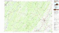
1983 Map of Winchester
USGS Topo · Published 1985About this map
Winchester stands as the primary hub in this early 1980s landscape, where the northern Shenandoah Valley meets the ridgelines of the Appalachian Mountains. The map highlights the region's complex terrain, defined by the parallel runs of Great North Mountain and Sideling Hill. This period shows a well-established road network, including the intersection of US 50 and I-81, while the B & O RR and Norfolk and Western RR lines trace the industrial corridors that supported local commerce.
Find a feature on this map
207 named features on this map. Tap any name to fly to it.
Don’t see what you’re looking for? This feature index may not catch every label — zoom into the map to look around manually.
Map Details
Editions of this 1983 Winchester Map
3 editions found
Other maps of this area

1884 · Harpers Ferry
USGS Topo · 1:125,000

1891 · Harpers Ferry
USGS Topo · 1:125,000

1891 · Romney
USGS Topo · 1:125,000

1892 · Franklin
USGS Topo · 1:125,000

1892 · Woodstock
USGS Topo · 1:125,000

1893 · Luray
USGS Topo · 1:125,000

1893 · Harpers Ferry
USGS Topo · 1:125,000

1894 · Warrenton
USGS Topo · 1:125,000

1894 · Winchester
USGS Topo · 1:125,000

1895 · Piedmont
USGS Topo · 1:125,000