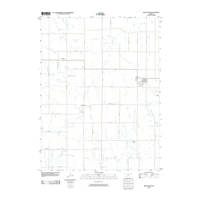
2009 Map of Winchester
USGS Topo · Published 2009About this map
Winchester serves as the primary hub of this Jefferson County landscape, characterized by a structured grid of agricultural roads and several small named settlements. The town is home to the Winchester Post Office, while outlying areas include the small communities of Boyle to the northwest and Dunavant further south along Crooked Creek. This era of the landscape is defined by its deep-rooted rural infrastructure, with multiple burial grounds such as Spring Grove Cemetery and Wise Cemetery anchoring the local geography. A network of waterways, including Fishpond Creek and Honey Creek, cuts across the rectilinear section lines, illustrating how the natural drainage of the Kansas prairie interacts with a century of human parceling and land use.
Find a feature on this map
38 named features on this map. Tap any name to fly to it.
Don’t see what you’re looking for? This feature index may not catch every label — zoom into the map to look around manually.
Map Details
Editions of this 2009 Winchester Map
This is the sole edition of this map. No revisions or reprints were ever made.
Other maps of this area

1886 · Oskaloosa
USGS Topo · 1:125,000

1888 · Oskaloosa
USGS Topo · 1:125,000

1894 · Oskaloosa
USGS Topo · 1:125,000

1950 · Kansas City
USGS Topo · 1:250,000

1950 · Mc Louth
USGS Topo · 1:24,000
1951 · Mc Louth
USGS Topo · 1:24,000
1951 · Oskaloosa
USGS Topo · 1:24,000

1951 · Ozawkie
USGS Topo · 1:24,000

1954 · Kansas City
USGS Topo · 1:250,000

1956 · Kansas City
USGS Topo · 1:250,000