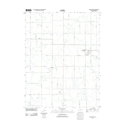
2012 Map of Winchester
USGS Topo · Published 2012About this map
Winchester serves as the primary hub of this eastern Kansas landscape, situated near the intersection of several regional routes and the local Post Office. The surrounding terrain in Jefferson County is defined by a dense network of watercourses, including the winding Crooked Creek and Honey Creek, which cut through the agricultural sections. The map illustrates a transitional rural economy where traditional small settlements like Boyle and Dunavant persist alongside modern infrastructure such as the Flying T Airport and the Winchester Wastewater Treatment Facility. To the southwest, the Fairview Cemetery near 122nd Street provides a point of interest for genealogists tracing local families. The grid of country roads, including Hickory Point Road and Marion Road, connects scattered farmsteads and creek crossings like those at Fishpond Creek and Little Slough Creek.
Find a feature on this map
46 named features on this map. Tap any name to fly to it.
Don’t see what you’re looking for? This feature index may not catch every label — zoom into the map to look around manually.
Map Details
Editions of this 2012 Winchester Map
This is the sole edition of this map. No revisions or reprints were ever made.
Other maps of this area

1886 · Oskaloosa
USGS Topo · 1:125,000

1888 · Oskaloosa
USGS Topo · 1:125,000

1894 · Oskaloosa
USGS Topo · 1:125,000

1950 · Kansas City
USGS Topo · 1:250,000

1950 · Mc Louth
USGS Topo · 1:24,000
1951 · Mc Louth
USGS Topo · 1:24,000
1951 · Oskaloosa
USGS Topo · 1:24,000

1951 · Ozawkie
USGS Topo · 1:24,000

1954 · Kansas City
USGS Topo · 1:250,000

1956 · Kansas City
USGS Topo · 1:250,000