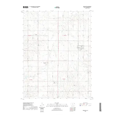
2018 Map of Winchester
USGS Topo · Published 2018About this map
Winchester anchors this portion of Jefferson County, sitting at the junction of local routes like Delaware St and 7th St. The landscape is defined by an intricate network of watercourses including Crooked Cr and Rock Cr, which carve through the agricultural terrain. Small rural hubs such as Boyle and Dunavant appear alongside the gridded section lines of the Public Land Survey System, reflecting the organized settlement patterns of the Kansas plains. Genealogy researchers will find several well-documented burial grounds, including Spring Grove Cem, Plum Grove Cem, and Fairview Cem, situated near established family farmsteads. The inclusion of the Flying T Airport provides a modern navigational landmark amidst the traditional rural road network of named corridors like Hickory Point Rd and Saline Rd.
Find a feature on this map
52 named features on this map. Tap any name to fly to it.
Don’t see what you’re looking for? This feature index may not catch every label — zoom into the map to look around manually.
Map Details
Editions of this 2018 Winchester Map
This is the sole edition of this map. No revisions or reprints were ever made.
Other maps of this area

1886 · Oskaloosa
USGS Topo · 1:125,000

1888 · Oskaloosa
USGS Topo · 1:125,000

1894 · Oskaloosa
USGS Topo · 1:125,000

1950 · Kansas City
USGS Topo · 1:250,000

1950 · Mc Louth
USGS Topo · 1:24,000
1951 · Mc Louth
USGS Topo · 1:24,000
1951 · Oskaloosa
USGS Topo · 1:24,000

1951 · Ozawkie
USGS Topo · 1:24,000

1954 · Kansas City
USGS Topo · 1:250,000

1956 · Kansas City
USGS Topo · 1:250,000