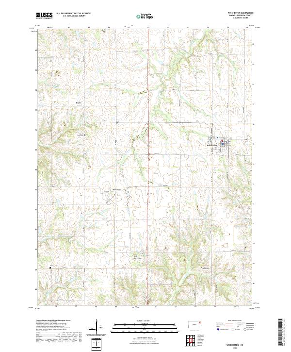
2022 Map of Winchester
USGS Topo · Published 2022About this map
Winchester serves as the primary hub of this Jefferson County landscape, where the local road grid organizes a terrain defined by numerous small waterways. The township structure is clearly delineated by a network of numbered streets and named roads such as Saline Rd and Nemaha Rd, which connect smaller nodes like Dunavant and Boyle. These smaller settlements, though less developed than the central town, represent the rural crossroads that once anchored the local agricultural community.
Find a feature on this map
53 named features on this map. Tap any name to fly to it.
Don’t see what you’re looking for? This feature index may not catch every label — zoom into the map to look around manually.
Map Details
Editions of this 2022 Winchester Map
This is the sole edition of this map. No revisions or reprints were ever made.
Other maps of this area

1886 · Oskaloosa
USGS Topo · 1:125,000

1888 · Oskaloosa
USGS Topo · 1:125,000

1894 · Oskaloosa
USGS Topo · 1:125,000

1950 · Kansas City
USGS Topo · 1:250,000

1950 · Mc Louth
USGS Topo · 1:24,000
1951 · Mc Louth
USGS Topo · 1:24,000
1951 · Oskaloosa
USGS Topo · 1:24,000

1951 · Ozawkie
USGS Topo · 1:24,000

1954 · Kansas City
USGS Topo · 1:250,000

1956 · Kansas City
USGS Topo · 1:250,000