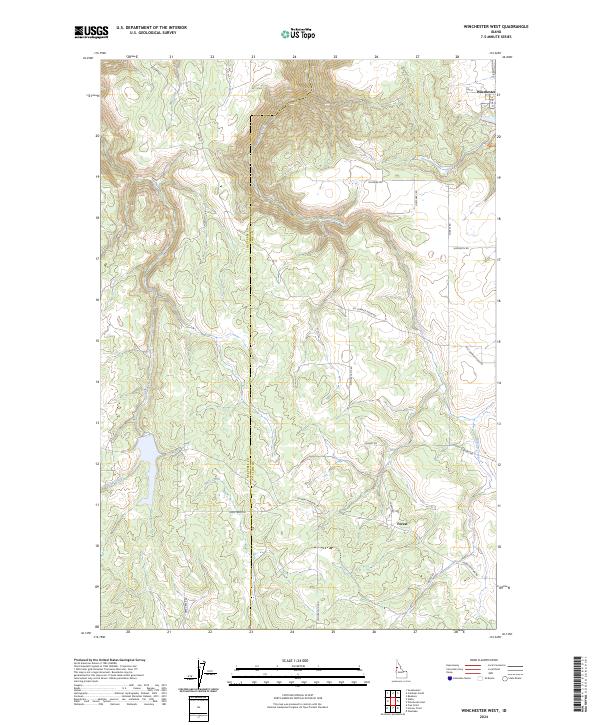
2024 Map of Winchester West
USGS Topo · Published 2024About this map
The town of Winchester sits at the edge of the Camas Prairie, marking a distinct transition from the agricultural plateaus of the Nez Perce Reservation into the deeply incised drainages of the Clearwater River basin. This survey documents a landscape where steep canyon walls and densely forested ridges dictate the path of local travel, largely restricted to ridge-top routes and valley floors. The mapping reflects the enduring patterns of Lewis County’s rural infrastructure, where isolated homesteads and forest access roads weave through the complex topography of the Craig Mountains. These features illustrate the geographic challenges faced by early settlers and modern forest managers alike, providing a precise look at the land use and natural boundaries that characterize this part of North Central Idaho.
Find a feature on this map
1 named feature on this map. Tap any name to fly to it.
Don’t see what you’re looking for? This feature index may not catch every label — zoom into the map to look around manually.
Map Details
Editions of this 2024 Winchester West Map
This is the sole edition of this map. No revisions or reprints were ever made.
Other maps of this area

1946 · Limekiln Rapids
USGS Topo · 1:62,500

1955 · Pullman
USGS Topo · 1:250,000

1958 · Pullman
USGS Topo · 1:250,000

1958 · Sweetwater
USGS Topo · 1:24,000

1958 · Lewiston Orchards
USGS Topo · 1:62,500

1958 · Culdesac
USGS Topo · 1:62,500

1967 · Hoover Point
USGS Topo · 1:24,000

1967 · Westlake
USGS Topo · 1:24,000
1967 · Winchester East
USGS Topo · 1:24,000

1968 · Waha
USGS Topo · 1:24,000