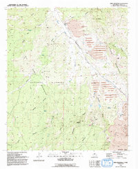
1992 Map of Wind Mountain
USGS Topo · Published 1992About this map
The Little Burro Mountains and Big Burro Mountains converge in this high-desert landscape of southwestern New Mexico. Industrial activity dominates the eastern half of the map, centered on the massive operations at the Tyrone Mine and several neighboring open pits, including the Liberty Bell Mine. A complex system of levees and multiple Tailings Ponds occupy the Mangas Valley, illustrating the significant environmental impact of late-20th-century extraction. In contrast, the western portion of the quadrangle belongs to the Gila National Forest, where the terrain is carved by rugged drainage systems like Sawmill Canyon and Maverick Canyon. The Continental Divide cuts across the southern edge, marking the hydrological crest between these industrial and protected forest lands. Water sources are critical in this arid environment, evidenced by scattered points like McCain Spring and Silver Dale Spring.
Find a feature on this map
42 named features on this map. Tap any name to fly to it.
Don’t see what you’re looking for? This feature index may not catch every label — zoom into the map to look around manually.
Map Details
Editions of this 1992 Wind Mountain Map
This is the sole edition of this map. No revisions or reprints were ever made.
Other maps of this area

1909 · Silver City
USGS Topo · 1:125,000

1949 · Circle Mesa
USGS Topo · 1:24,000

1950 · Tyrone
USGS Topo · 1:24,000

1950 · White Signal
USGS Topo · 1:24,000

1950 · Wind Mountain
USGS Topo · 1:24,000

1950 · Burro Peak
USGS Topo · 1:24,000

1950 · Silver City
USGS Topo · 1:24,000

1951 · Circle Mesa
USGS Topo · 1:24,000

1951 · White Signal
USGS Topo · 1:24,000
1951 · Silver City
USGS Topo · 1:24,000