
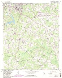
1964 Map of Winder South
USGS Topo · Published 1986About this map
The Apalachee River forms a natural boundary between Barrow, Walton, and Oconee Counties in this mid-1960s survey, updated with purple revisions in the early 1980s. The landscape is defined by the transition from the growing urban center of Winder and Barrow Heights to the south's agricultural and wooded terrain. Significant historical footprints include the Old Fort and the Apalachee Covered Bridge, which provide a look at early infrastructure before more modern developments like the Winder Airport and Fort Yargo State Park emerged.
Find a feature on this map
70 named features on this map. Tap any name to fly to it.
Don’t see what you’re looking for? This feature index may not catch every label — zoom into the map to look around manually.
Map Details
Editions of this 1964 Winder South Map
3 editions found

Other maps of this area

1891 · Gainesville
USGS Topo · 1:125,000

1896 · Monroe
USGS Topo · 1:125,000

1953 · Athens
USGS Topo · 1:250,000

1954 · Greenville
USGS Topo · 1:250,000

1958 · Greenville
USGS Topo · 1:250,000

1958 · Athens
USGS Topo · 1:250,000

1959 · Athens
USGS Topo · 1:250,000

1963 · Athens
USGS Topo · 1:250,000

1964 · Bold Springs
USGS Topo · 1:24,000

1964 · Between
USGS Topo · 1:24,000