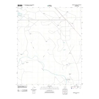
2010 Map of Windmill Draw
USGS Topo · Published 2010About this map
The Pecos River carves a winding path through this De Baca County landscape, anchoring a ranching environment defined by critical water sources and livestock infrastructure. In the southeast, the Fort Sumner Diversion Dam manages the river's flow, while the surrounding terrain is marked by significant landholdings such as York Ranch, Walton Ranch, and Brassell Ranch. The map highlights the essential role of localized water management in New Mexico's arid ranchlands, evidenced by numerous named wells like Hale Windmill, Star Windmill, and East Windmill.
Find a feature on this map
28 named features on this map. Tap any name to fly to it.
Don’t see what you’re looking for? This feature index may not catch every label — zoom into the map to look around manually.
Map Details
Editions of this 2010 Windmill Draw Map
This is the sole edition of this map. No revisions or reprints were ever made.
Other maps of this area

1954 · Fort Sumner
USGS Topo · 1:250,000

1958 · Fort Sumner
USGS Topo · 1:250,000

1965 · Fort Sumner West
USGS Topo · 1:24,000

1965 · Windmill Draw
USGS Topo · 1:24,000

1966 · Gibbons Ranch
USGS Topo · 1:24,000

1966 · Ricardo
USGS Topo · 1:24,000

1966 · Alamogordo Dam
USGS Topo · 1:24,000

1966 · Colorado Canyon
USGS Topo · 1:24,000

1968 · Twin Mesa NW
USGS Topo · 1:24,000

1968 · Fort Sumner East
USGS Topo · 1:24,000