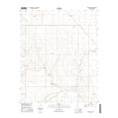
2017 Map of Windmill Draw
USGS Topo · Published 2017About this map
Lake Sumner and the Pecos River dominate this 2017 survey of De Baca County, revealing a landscape defined by its scarce water sources. The map tracks the winding course of the river through high plateau country, where intermittent drainages like Windmill Draw and Dark Canyon provide the primary topographic relief. This modern topographic study shows the critical importance of localized water points in the high desert, documenting named sites such as Sand Spring, Carretas Springs, and the Old Water Hole. The region is crisscrossed by established routes including Cornerstone Rd and Carretas Rd, which link remote grazing lands and overlook features like Pacheco Bluff. The detailed contour lines illustrate the sharp transitions between the river valley and the surrounding mesas, providing a precise record of the hydrologic network including the Arroyo de Anil.
Find a feature on this map
23 named features on this map. Tap any name to fly to it.
Don’t see what you’re looking for? This feature index may not catch every label — zoom into the map to look around manually.
Map Details
Editions of this 2017 Windmill Draw Map
This is the sole edition of this map. No revisions or reprints were ever made.
Other maps of this area

1954 · Fort Sumner
USGS Topo · 1:250,000

1958 · Fort Sumner
USGS Topo · 1:250,000

1965 · Fort Sumner West
USGS Topo · 1:24,000

1965 · Windmill Draw
USGS Topo · 1:24,000

1966 · Gibbons Ranch
USGS Topo · 1:24,000

1966 · Ricardo
USGS Topo · 1:24,000

1966 · Alamogordo Dam
USGS Topo · 1:24,000

1966 · Colorado Canyon
USGS Topo · 1:24,000

1968 · Twin Mesa NW
USGS Topo · 1:24,000

1968 · Fort Sumner East
USGS Topo · 1:24,000