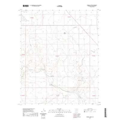
2023 Map of Windmill Draw
USGS Topo · Published 2023About this map
Lake Sumner and the surrounding high desert plains of De Baca County define this landscape, where the Pecos River carves a winding path through the center of the terrain. The river's course is marked by significant topographical breaks such as Pacheco Bluff and the confluence of deep drainages like Dark Canyon and Windmill Draw. This is a water-scarce environment where localized names reflect the vital importance of every source, from the Old Water Hole to more reliable flows like Arenosa Spring and Carretas Springs.
Find a feature on this map
24 named features on this map. Tap any name to fly to it.
Don’t see what you’re looking for? This feature index may not catch every label — zoom into the map to look around manually.
Map Details
Editions of this 2023 Windmill Draw Map
This is the sole edition of this map. No revisions or reprints were ever made.
Other maps of this area

1954 · Fort Sumner
USGS Topo · 1:250,000

1958 · Fort Sumner
USGS Topo · 1:250,000

1965 · Fort Sumner West
USGS Topo · 1:24,000

1965 · Windmill Draw
USGS Topo · 1:24,000

1966 · Gibbons Ranch
USGS Topo · 1:24,000

1966 · Ricardo
USGS Topo · 1:24,000

1966 · Alamogordo Dam
USGS Topo · 1:24,000

1966 · Colorado Canyon
USGS Topo · 1:24,000

1968 · Twin Mesa NW
USGS Topo · 1:24,000

1968 · Fort Sumner East
USGS Topo · 1:24,000