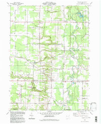
1994 Map of Windsor
USGS Topo · Published 1997About this map
The Grand River corridor defines the eastern reaches of this Ashtabula County landscape, designated here as the Grand State Wild and Scenic River. This 1994 update reveals a rural environment where agricultural land is segmented by deep creek beds, including Phelps Creek and Indian Creek. The settlement patterns are concentrated around historic crossroads like Hartsgrove and Windsor Mills, with the latter situated near the winding banks of the river.
Find a feature on this map
45 named features on this map. Tap any name to fly to it.
Don’t see what you’re looking for? This feature index may not catch every label — zoom into the map to look around manually.
Map Details
Editions of this 1994 Windsor Map
This is the sole edition of this map. No revisions or reprints were ever made.
Other maps of this area

1904 · Chardon
USGS Topo · 1:62,500

1905 · Bristolville
USGS Topo · 1:62,500

1905 · Garrettsville
USGS Topo · 1:62,500

1905 · Jefferson
USGS Topo · 1:62,500

1906 · Chardon
USGS Topo · 1:62,500

1907 · Bristolville
USGS Topo · 1:62,500

1907 · Jefferson
USGS Topo · 1:62,500

1907 · Garrettsville
USGS Topo · 1:62,500

1950 · Cleveland
USGS Topo · 1:250,000

1952 · West Farmington
USGS Topo · 1:24,000
Featured Places
- Mesopotamia Township, OH
- Windsor, OH
- Hartsgrove Township, OH
- Hartsgrove, Hartsgrove Township
- Bloomfield Township, OH