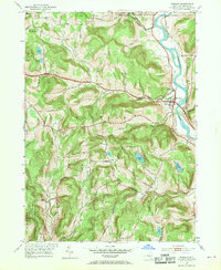
1952 Map of Windsor
USGS Topo · Published 1969About this map
The Susquehanna River defines the eastern corridor of this Broome County landscape, where the village of Windsor serves as a primary hub for the surrounding rural townships. The settlement pattern follows the valley floors and higher ridgelines, connected by a network of local thoroughfares such as Pease Road and Sugar Bush Road. In the mid-century era, small communities like Occanum, Edson, and Blatchley remained distinct points of interest for local genealogy, often anchored by landmarks like the Central Sch or family-adjacent burying grounds including Riverside Cem and Knox Cem.
Find a feature on this map
52 named features on this map. Tap any name to fly to it.
Don’t see what you’re looking for? This feature index may not catch every label — zoom into the map to look around manually.
Map Details
Editions of this 1952 Windsor Map
3 editions found
Other maps of this area

1904 · Binghamton
USGS Topo · 1:62,500

1905 · Nineveh
USGS Topo · 1:62,500

1932 · Susquehanna
USGS Topo · 1:62,500

1935 · Chenango Forks
USGS Topo · 1:24,000

1935 · Susquehanna
USGS Topo · 1:62,500

1937 · Binghamton East
USGS Topo · 1:24,000

1942 · Chenango Forks
USGS Topo · 1:31,680

1942 · Binghamton East
USGS Topo · 1:31,680

1943 · Montrose
USGS Topo · 1:62,500

1945 · Montrose
USGS Topo · 1:62,500