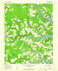
1944 Map of Windsor
USGS Topo · Published 1961About this map
The town of Windsor serves as a central hub on this 1944 survey, where the Norfolk and Western railroad intersects with a burgeoning road network. The landscape is defined by the complex hydrology of the Tidewater region, featuring a series of large millponds and reservoirs such as Lake Burnt Mills, Lake Prince, and Cahoon Pond. This period captures a transition in the rural economy, as older sites like Branch and Joyner Millpond and the String of Logs Pocosin remain prominent alongside modern developments like an underground pipeline.
Find a feature on this map
40 named features on this map. Tap any name to fly to it.
Don’t see what you’re looking for? This feature index may not catch every label — zoom into the map to look around manually.
Map Details
Editions of this 1944 Windsor Map
2 editions found
Other maps of this area

1919 · Smithfield
USGS Topo · 1:62,500

1919 · Suffolk
USGS Topo · 1:62,500

1920 · Holland
USGS Topo · 1:62,500

1920 · Ivor
USGS Topo · 1:62,500

1943 · Holland
USGS Topo · 1:62,500

1944 · Windsor
USGS Topo · 1:31,680

1944 · Smithfield
USGS Topo · 1:24,000

1944 · Raynor
USGS Topo · 1:24,000

1944 · Zuni
USGS Topo · 1:24,000

1945 · Zuni
USGS Topo · 1:31,680