2021 Map of Windsor
USGS Topo · Published 2021About this map
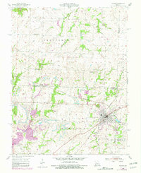
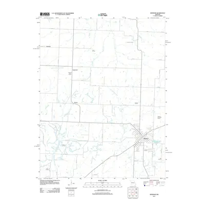
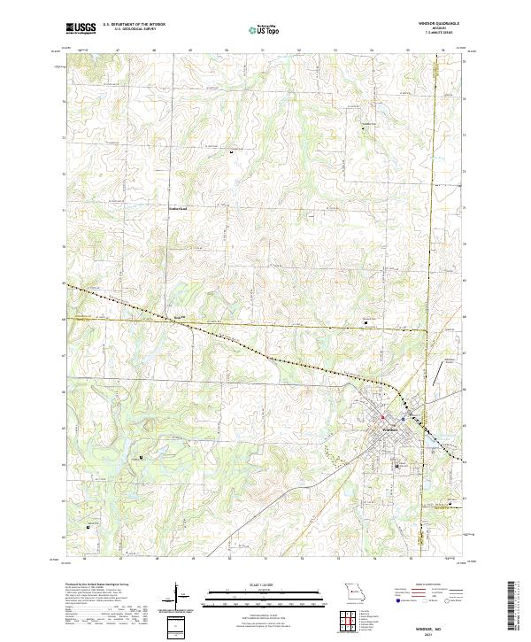
The city of Windsor serves as a central hub on this Missouri survey, situated at the junction of Henry, Pettis, Johnson, and Benton counties. The landscape is defined by the headwaters of several drainages, including the Clear Fork Blackwater River and the Middle Fork Tebo Cr. Transportation history is prominent here, as the modern Katy Trl and Rock Island Spur Trl occupy the former corridors of the region's vital rail lines. These routes pass through the smaller communities of Bowen and Sutherland, providing a look at the historical settlement patterns of the rural agricultural interior. Local heritage is preserved in numerous family and community burial grounds, such as Goodwin Cem and Chipman Cem. The area around Windsor Farrington Park Lake anchors the southern edge of town, while the Windsor Airport sits to the east, reflecting the continued utility of this regional crossroads.
Find a feature on this map
64 named features on this map. Tap any name to fly to it.
Don’t see what you’re looking for? This feature index may not catch every label — zoom into the map to look around manually.
Map Details
Editions of this 2021 Windsor Map
This is the sole edition of this map. No revisions or reprints were ever made.
Historical Maps of Windsor Through Time
5 maps found