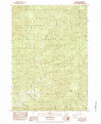
1984 Map of Windy Peak
USGS Topo · Published 1984About this map
Siuslaw National Forest dominates this mid-1980s topographical study of the Coast Range in western Lane County. The landscape is defined by an intricate network of waterways, most notably the winding course of Deadwood Creek and its many named tributaries. These drainages, including the North Fork, South Fork, and West Fork, create a deeply dissected terrain of steep ridges and narrow valleys.
Find a feature on this map
22 named features on this map. Tap any name to fly to it.
Don’t see what you’re looking for? This feature index may not catch every label — zoom into the map to look around manually.
Map Details
Editions of this 1984 Windy Peak Map
2 editions found
Other maps of this area

1918 · Mapleton
USGS Topo · 1:48,000

1940 · Mapleton
USGS Topo · 1:62,500

1941 · Blachly
USGS Topo · 1:62,500

1942 · Alsea
USGS Topo · 1:62,500

1942 · Blachly
USGS Topo · 1:62,500

1942 · Tidewater
USGS Topo · 1:62,500

1945 · Mapleton
USGS Topo · 1:62,500

1953 · Salem
USGS Topo · 1:250,000

1954 · Salem
USGS Topo · 1:250,000

1956 · Alsea
USGS Topo · 1:62,500