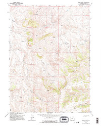
1962 Map of Windy Point
USGS Topo · Published 1995About this map
Bear River Divide cuts through the center of this Lincoln County landscape, separating the headwaters of numerous seasonal drainages. The topography is defined by the broad Bridger Basin and prominent elevations like Sillem Ridge and Windy Point. This early 1960s survey documents a network of water management features essential for high-altitude livestock ranching, including several small named catchments such as White Rock Reservoir, Question Mark Reservoir, and Pocket Reservoir. The terrain is marked by a series of springs feeding into Cottonwood Creek and Bridger Creek, which eventually reach the Bear River in the south. Unimproved 4WD tracks represent the primary infrastructure of the era, providing access to remote landmarks like High Top and Bridger Hill during a time when this part of the state remained focused on traditional open-range land use.
Find a feature on this map
25 named features on this map. Tap any name to fly to it.
Don’t see what you’re looking for? This feature index may not catch every label — zoom into the map to look around manually.
Map Details
Editions of this 1962 Windy Point Map
2 editions found
Other maps of this area

1912 · Randolph
USGS Topo · 1:125,000

1954 · Sage
USGS Topo · 1:62,500

1954 · Ogden
USGS Topo · 1:250,000

1958 · Ogden
USGS Topo · 1:250,000

1960 · Ogden
USGS Topo · 1:250,000

1962 · Bell Butte NE
USGS Topo · 1:24,000

1962 · Sawtooth Mountain
USGS Topo · 1:24,000

1962 · Windy Point
USGS Topo · 1:24,000

1962 · Bell Butte
USGS Topo · 1:24,000

1968 · Rex Peak
USGS Topo · 1:24,000