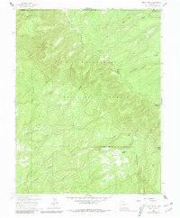
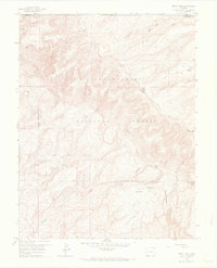
1960 Map of Windy Point
USGS Topo · Published 1981About this map
Uncompahgre National Forest spans this high-elevation landscape on the border of Mesa and Montrose counties. In 1960, the area remained largely undeveloped, characterized by a complex drainage system where Atkinson Creek and Tabeguache Creek carve through the plateau. Small-scale ranching and seasonal livestock operations are evident at The Meadows Ranch and Porters Cow Camp, which sit near the eponymous open expanse of The Meadows. This territory is defined by its topographic extremes, ranging from the prominent lookout at Windy Point to the surrounding heights of Spruce Mtn and Pinon Mtn. Historic transportation routes are limited to a network of unpaved paths, including the The Meadows Trail and the Forty-Seven Trail, which provided essential access for forest management and local ranching before the expansion of modern infrastructure.
Find a feature on this map
24 named features on this map. Tap any name to fly to it.
Don’t see what you’re looking for? This feature index may not catch every label — zoom into the map to look around manually.
Map Details
Editions of this 1960 Windy Point Map
5 editions found
Other maps of this area

1916 · Paradox Valley
USGS Topo · 1:125,000

1922 · Paradox Valley
USGS Topo · 1:125,000

1948 · Uravan
USGS Topo · 1:24,000

1949 · Uravan
USGS Topo · 1:24,000

1949 · Atkinson Creek
USGS Topo · 1:24,000

1950 · Atkinson Creek
USGS Topo · 1:24,000

1956 · Moab
USGS Topo · 1:250,000

1959 · Moab
USGS Topo · 1:250,000

1960 · Moab
USGS Topo · 1:250,000
1960 · Nucla
USGS Topo · 1:24,000