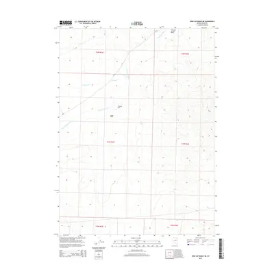
2014 Map of Wine Cup Ranch NE
USGS Topo · Published 2014About this map
Thousand Springs Valley defines this portion of northeastern Elko County, where the landscape is etched by a network of seasonal drainage and wide basins. The hydrologic character of the high desert is evident in the path of Thousand Springs Cr, which is joined by Van Eaton Cr as it winds through the valley floor. These watercourses, though often intermittent, historically dictated the movement of livestock and early travelers through the Great Basin.
Find a feature on this map
12 named features on this map. Tap any name to fly to it.
Don’t see what you’re looking for? This feature index may not catch every label — zoom into the map to look around manually.
Map Details
Editions of this 2014 Wine Cup Ranch NE Map
This is the sole edition of this map. No revisions or reprints were ever made.
Other maps of this area

1955 · Wells
USGS Topo · 1:250,000

1958 · Wells
USGS Topo · 1:250,000

1961 · Wells
USGS Topo · 1:250,000

1961 · Delano Mountains
USGS Topo · 1:62,500

1967 · Ninemile Mtn SW
USGS Topo · 1:24,000

1967 · Ninemile Mtn
USGS Topo · 1:24,000

1968 · Knoll Mountain
USGS Topo · 1:24,000

1968 · Knoll Mountain SE
USGS Topo · 1:24,000

1968 · Wine Cup Ranch SE
USGS Topo · 1:24,000

1968 · Wine Cup Ranch
USGS Topo · 1:24,000