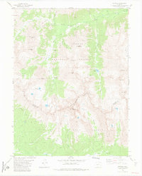
1982 Map of Winfield
USGS Topo · Published 1983About this map
Winfield and Vicksburg occupy the narrow valley floor of Clear Creek, serving as primary nodes of human activity in this high-altitude landscape. Published in the early 1980s, the map details a region defined by the Continental Divide, where the boundary between San Isabel National Forest and Gunnison National Forest follows the jagged ridgeline. The area’s extractive history is evident through numerous prospects and the Banker Mine, while the transition from mining to recreation is reflected in the network of pack trails and jeep tracks leading to alpine features like The Three Apostles and Huron Peak. Significant water bodies such as Clohesy Lake and Lake Ann are tucked into the steep basins below the Divide. This record shows the enduring footprint of historic settlements like Rockdale and Hamilton amidst the massive peaks of the Sawatch Range.
Find a feature on this map
40 named features on this map. Tap any name to fly to it.
Don’t see what you’re looking for? This feature index may not catch every label — zoom into the map to look around manually.
Map Details
Editions of this 1982 Winfield Map
3 editions found
Other maps of this area

1889 · Leadville
USGS Topo · 1:125,000

1891 · Leadville
USGS Topo · 1:125,000

1909 · Mount Jackson
USGS Topo · 1:125,000

1911 · Mount Jackson
USGS Topo · 1:125,000

1934 · Taylor Park
USGS Topo · 1:62,500

1935 · Mount Elbert
USGS Topo · 1:62,500

1937 · Taylor Park
USGS Topo · 1:62,500

1938 · Mount Elbert
USGS Topo · 1:62,500

1939 · Mount Elbert
USGS Topo · 1:62,500

1942 · Leadville
USGS Topo · 1:125,000