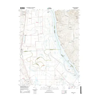
2015 Map of Winfield
USGS Topo · Published 2015About this map
The Mississippi River and its complex network of sloughs and islands dominate this landscape at the junction of Lincoln Co and St. Charles Co. The convergence of the Cuivre River and the Cuivre Canal near Old Monroe highlights the importance of water management and transport in this riverine region. Low-lying wetlands are punctuated by Numerous lakes, including Horseshoe Lake, Brush Lake, and Bernard Lake, which contrast with the higher elevations of Indian Hill and the Dividing Ridge to the east.
Find a feature on this map
94 named features on this map. Tap any name to fly to it.
Don’t see what you’re looking for? This feature index may not catch every label — zoom into the map to look around manually.
Map Details
Editions of this 2015 Winfield Map
This is the sole edition of this map. No revisions or reprints were ever made.
Other maps of this area

1903 · O'Fallon
USGS Topo · 1:125,000

1930 · Hardin
USGS Topo · 1:62,500

1931 · Brussels
USGS Topo · 1:62,500

1934 · Elsberry
USGS Topo · 1:48,000

1934 · Hardin
USGS Topo · 1:62,500

1938 · Hardin
USGS Topo · 1:62,500

1939 · Brussels
USGS Topo · 1:62,500

1941 · Troy
USGS Topo · 1:62,500

1942 · Elsberry
USGS Topo · 1:62,500

1943 · Brussels
USGS Topo · 1:62,500