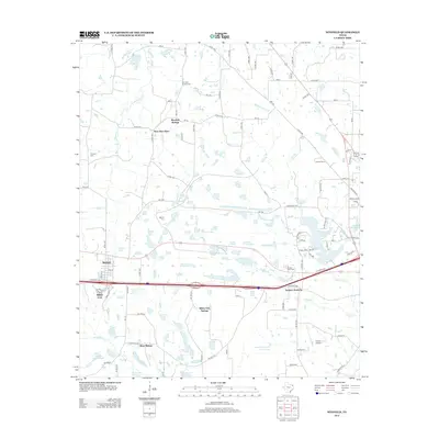
2013 Map of Winfield
USGS Topo · Published 2013About this map
The town of Winfield serves as the focal point of this Titus County landscape, situated along a primary east-west transportation corridor that bisects the terrain. To the south, the expansive Monticello Reservoir and its associated reservoir branches influence the local hydrology and land use patterns, while small settlements like Millers Cove and West Midway dot the surrounding area. The map illustrates a transition from the structured street grid of Winfield to the more dispersed agricultural and residential character of nearby Farmers Academy and West New Hope.
Find a feature on this map
99 named features on this map. Tap any name to fly to it.
Don’t see what you’re looking for? This feature index may not catch every label — zoom into the map to look around manually.
Map Details
Editions of this 2013 Winfield Map
This is the sole edition of this map. No revisions or reprints were ever made.
Other maps of this area

1953 · Texarkana
USGS Topo · 1:250,000

1956 · Texarkana
USGS Topo · 1:250,000

1964 · Mount Vernon
USGS Topo · 1:24,000

1964 · Harvard
USGS Topo · 1:24,000

1964 · Wilkinson
USGS Topo · 1:24,000

1964 · Talco
USGS Topo · 1:24,000

1964 · Hagansport
USGS Topo · 1:24,000

1965 · Winfield
USGS Topo · 1:24,000

1965 · Monticello
USGS Topo · 1:24,000
1965 · New Hope
USGS Topo · 1:24,000