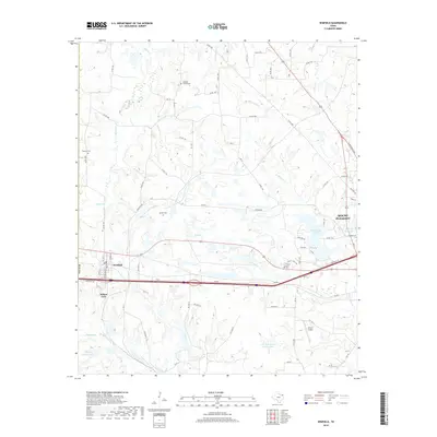
2019 Map of Winfield
USGS Topo · Published 2019About this map
Winfield and the western edge of Mount Pleasant anchor this Titus County landscape, reflecting the modern layout of Northeast Texas as of 2019. The area is defined by a dense network of county roads and state highways that connect scattered residential pockets with larger water features. Significant man-made reservoirs like Tankersley Lake, John W May Lake, and John B Stephens Junior Lake indicate the importance of water management and recreation in this part of the county.
Find a feature on this map
77 named features on this map. Tap any name to fly to it.
Don’t see what you’re looking for? This feature index may not catch every label — zoom into the map to look around manually.
Map Details
Editions of this 2019 Winfield Map
This is the sole edition of this map. No revisions or reprints were ever made.
Other maps of this area

1953 · Texarkana
USGS Topo · 1:250,000

1956 · Texarkana
USGS Topo · 1:250,000

1964 · Mount Vernon
USGS Topo · 1:24,000

1964 · Harvard
USGS Topo · 1:24,000

1964 · Wilkinson
USGS Topo · 1:24,000

1964 · Talco
USGS Topo · 1:24,000

1964 · Hagansport
USGS Topo · 1:24,000

1965 · Winfield
USGS Topo · 1:24,000

1965 · Monticello
USGS Topo · 1:24,000
1965 · New Hope
USGS Topo · 1:24,000