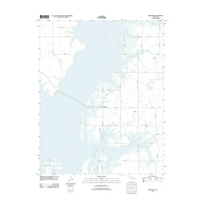
2013 Map of Winganon
USGS Topo · Published 2013About this map
Oologah Lake dominates this 2013 survey of the Oklahoma landscape, with its irregular, many-fingered shoreline creating a complex geography of peninsulas and inlets. The small settlement of Winganon sits at the center of the sheet, connected to the western shore by a long causeway that carries East 300 Road across the water. This crossing is a vital link in the local transportation network, which otherwise consists of a strictly gridded system of numbered county roads like S 4200 Rd and E 290 Rd that navigate the remaining dry land.
Find a feature on this map
30 named features on this map. Tap any name to fly to it.
Don’t see what you’re looking for? This feature index may not catch every label — zoom into the map to look around manually.
Map Details
Editions of this 2013 Winganon Map
This is the sole edition of this map. No revisions or reprints were ever made.
Other maps of this area

1896 · Pryor
USGS Topo · 1:125,000

1901 · Claremore
USGS Topo · 1:125,000

1901 · Nowata
USGS Topo · 1:125,000

1901 · Vinita
USGS Topo · 1:125,000

1901 · Pryor
USGS Topo · 1:125,000

1913 · Vinita
USGS Topo · 1:125,000

1914 · Nowata
USGS Topo · 1:125,000

1914 · Claremore
USGS Topo · 1:125,000

1916 · Claremore
USGS Topo · 1:125,000

1954 · Tulsa
USGS Topo · 1:250,000