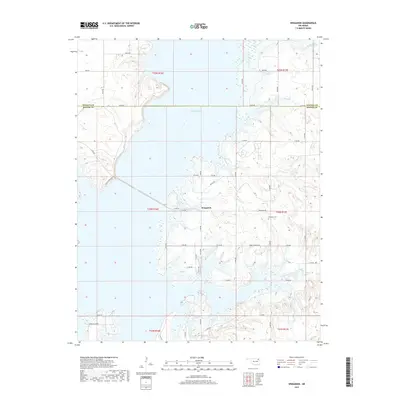
2019 Map of Winganon
USGS Topo · Published 2019About this map
Oologah Lake dominates this 2019 survey, its expansive waters filling the Verdigris River valley and creating a complex shoreline of inlets and peninsulas. The unincorporated community of Winganon sits at the junction of E 320 Rd and S 4180 Rd, serving as a focal point for the surrounding rural area. Genealogists can locate the Winganon Cem north of Rabbit Springs Rd, preserved amid the rolling terrain of the Cherokee Nation's historic lands. The map details a network of section-line roads, such as E0290 Rd, which defines the boundary between Nowata and Rogers counties. To the north and south, several tributaries including Plumb Cr and Spencer Cr feed into the reservoir, while Goose Island Rd provides access to the lake's southern reaches.
Find a feature on this map
46 named features on this map. Tap any name to fly to it.
Don’t see what you’re looking for? This feature index may not catch every label — zoom into the map to look around manually.
Map Details
Editions of this 2019 Winganon Map
This is the sole edition of this map. No revisions or reprints were ever made.
Other maps of this area

1896 · Pryor
USGS Topo · 1:125,000

1901 · Claremore
USGS Topo · 1:125,000

1901 · Nowata
USGS Topo · 1:125,000

1901 · Vinita
USGS Topo · 1:125,000

1901 · Pryor
USGS Topo · 1:125,000

1913 · Vinita
USGS Topo · 1:125,000

1914 · Nowata
USGS Topo · 1:125,000

1914 · Claremore
USGS Topo · 1:125,000

1916 · Claremore
USGS Topo · 1:125,000

1954 · Tulsa
USGS Topo · 1:250,000