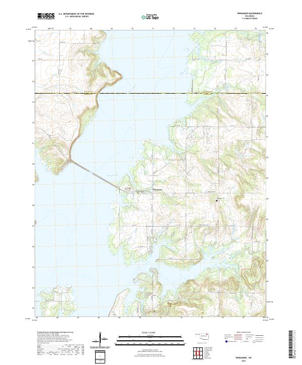
2022 Map of Winganon
USGS Topo · Published 2022About this map
Oologah Lake dominates this landscape along the border of Nowata and Rogers counties, where the impounded waters of the Verdigris River have reshaped the local geography. The small settlement of Winganon sits just east of the shoreline, serving as a focal point for a network of rural roads such as Winganon Rd and Rabbit Springs Rd. To the northeast, Winganon Cem remains a significant site for local family history, situated on higher ground above the inlets created by Plumb Creek. The map details the complex shoreline of the reservoir, including numerous fingers of water reaching into former creek beds like Spencer Creek and Panther Cr. This modern survey illustrates how the creation of the lake integrated with the existing section-line road system, as seen with corridors like Allens Point Dr providing access to the water's edge.
Find a feature on this map
45 named features on this map. Tap any name to fly to it.
Don’t see what you’re looking for? This feature index may not catch every label — zoom into the map to look around manually.
Map Details
Editions of this 2022 Winganon Map
This is the sole edition of this map. No revisions or reprints were ever made.
Other maps of this area

1896 · Pryor
USGS Topo · 1:125,000

1901 · Claremore
USGS Topo · 1:125,000

1901 · Nowata
USGS Topo · 1:125,000

1901 · Vinita
USGS Topo · 1:125,000

1901 · Pryor
USGS Topo · 1:125,000

1913 · Vinita
USGS Topo · 1:125,000

1914 · Nowata
USGS Topo · 1:125,000

1914 · Claremore
USGS Topo · 1:125,000

1916 · Claremore
USGS Topo · 1:125,000

1954 · Tulsa
USGS Topo · 1:250,000