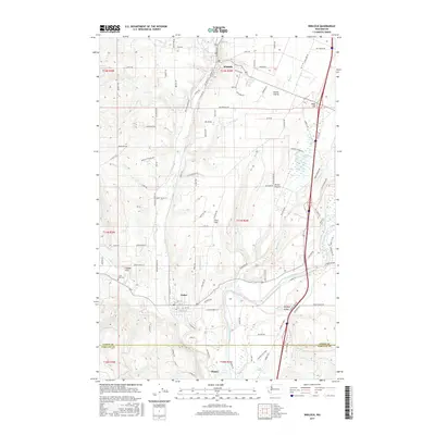
2017 Map of Winlock
USGS Topo · Published 2017About this map
Winlock and Vader anchor this landscape along the southern edge of Lewis County, where the terrain transitions toward the Cowlitz River valley. The map reveals a complex network of prairie lands and creek drainages, including Grand Prairie and Drews Prairie, which historically supported the region's agricultural development. The winding course of Olequa Cr serves as a primary geographical spine, flowing south past Finn Hill toward the settlement of Olequa. Genealogists and local historians can locate several specific landmarks, such as Little Falls Cem near Cougar Flat, and trace the rural road system that connects family-named areas like Smokey Valley. The southern boundary of the map marks the transition into Cowlitz County, anchored by the preserved acreage of Barnes State Park along the riverbanks.
Find a feature on this map
113 named features on this map. Tap any name to fly to it.
Don’t see what you’re looking for? This feature index may not catch every label — zoom into the map to look around manually.
Map Details
Editions of this 2017 Winlock Map
This is the sole edition of this map. No revisions or reprints were ever made.
Other maps of this area

1916 · Chehalis
USGS Topo · 1:125,000

1941 · Meskill
USGS Topo · 1:62,500

1941 · Olequa
USGS Topo · 1:62,500

1953 · Hoquiam
USGS Topo · 1:250,000

1953 · Castle Rock
USGS Topo · 1:62,500

1953 · Ryderwood
USGS Topo · 1:62,500

1953 · Adna
USGS Topo · 1:62,500

1954 · Centralia
USGS Topo · 1:62,500

1957 · Hoquiam
USGS Topo · 1:250,000

1958 · Hoquiam
USGS Topo · 1:250,000