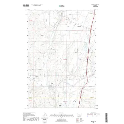
2020 Map of Winlock
USGS Topo · Published 2020About this map
Winlock and Vader anchor this section of Lewis and Cowlitz counties, where the modern industrial landscape follows historical patterns of transit and topography. The BNSF Railway corridor parallels the meandering path of Olequa Cr, a route that historically connected these timber and agricultural communities to the larger regional markets. The map reveals the distinct transition between the low-lying Smokey Valley along the Cowlitz River and the elevated, open grounds of Grand Prairie and Drews Prairie. Genealogists and local historians can pinpoint the Winlock Cem north of the town center and the Little Falls Cem near Cougar Flat, while many family-named roads like Knowles Rd and Minkler Rd suggest the legacy of early land claims in this part of Washington.
Find a feature on this map
115 named features on this map. Tap any name to fly to it.
Don’t see what you’re looking for? This feature index may not catch every label — zoom into the map to look around manually.
Map Details
Editions of this 2020 Winlock Map
This is the sole edition of this map. No revisions or reprints were ever made.
Other maps of this area

1916 · Chehalis
USGS Topo · 1:125,000

1941 · Meskill
USGS Topo · 1:62,500

1941 · Olequa
USGS Topo · 1:62,500

1953 · Hoquiam
USGS Topo · 1:250,000

1953 · Castle Rock
USGS Topo · 1:62,500

1953 · Ryderwood
USGS Topo · 1:62,500

1953 · Adna
USGS Topo · 1:62,500

1954 · Centralia
USGS Topo · 1:62,500

1957 · Hoquiam
USGS Topo · 1:250,000

1958 · Hoquiam
USGS Topo · 1:250,000