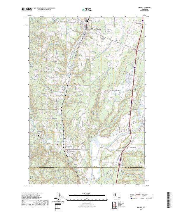
2023 Map of Winlock
USGS Topo · Published 2023About this map
Winlock and the surrounding Lewis County countryside are defined by a complex network of waterways and early rail corridors in this modern topographic study. The BNSF Railway follows the valley floor, connecting the settlements of Vader and Olequa as it runs parallel to the winding course of Olequa Creek. This corridor has long been the backbone of local transport, situated between the timbered heights of Finn Hill and the banks of the Cowlitz River to the south. Genealogists will find significant detail in the placement of rural burial grounds, including Winlock Cem and Little Falls Cem. The landscape transitions from the residential blocks of small towns to the open flats of Grand Prairie and Smokey Valley, while the southern reaches of the map include the protected woodlands of Barnes State Park near the Cowlitz County line.
Find a feature on this map
121 named features on this map. Tap any name to fly to it.
Don’t see what you’re looking for? This feature index may not catch every label — zoom into the map to look around manually.
Map Details
Editions of this 2023 Winlock Map
This is the sole edition of this map. No revisions or reprints were ever made.
Other maps of this area

1916 · Chehalis
USGS Topo · 1:125,000

1941 · Meskill
USGS Topo · 1:62,500

1941 · Olequa
USGS Topo · 1:62,500

1953 · Hoquiam
USGS Topo · 1:250,000

1953 · Castle Rock
USGS Topo · 1:62,500

1953 · Ryderwood
USGS Topo · 1:62,500

1953 · Adna
USGS Topo · 1:62,500

1954 · Centralia
USGS Topo · 1:62,500

1957 · Hoquiam
USGS Topo · 1:250,000

1958 · Hoquiam
USGS Topo · 1:250,000