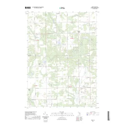
2023 Map of Winn
USGS Topo · Published 2023About this map
Winn serves as a central hub in this Isabella County landscape, where the agricultural grid is defined by the winding course of the Chippewa River and its numerous tributaries. Small rural communities like Deerfield Center, Rolland Center, and Two Rivers anchor the surrounding townships, reflecting a settlement pattern deeply rooted in local farming and regional transit. The map reveals a high density of rural burial grounds, including Saint Leo's Cem, Zion Cem, and the Broomfield Number One Cem, providing significant points of interest for genealogists tracing family histories in the area. Water features such as Woodruff Lake, Campau Lake, and Stony Brook intersect with a developed road network, while the Woodruff Lake Airport indicates a level of modern utility integrated into this traditionally agrarian space.
Find a feature on this map
59 named features on this map. Tap any name to fly to it.
Don’t see what you’re looking for? This feature index may not catch every label — zoom into the map to look around manually.
Map Details
Editions of this 2023 Winn Map
This is the sole edition of this map. No revisions or reprints were ever made.
Other maps of this area

1916 · Mount Pleasant
USGS Topo · 1:62,500

1919 · Mount Pleasant
USGS Topo · 1:62,500

1943 · Mount Pleasant
USGS Topo · 1:62,500

1954 · Midland
USGS Topo · 1:250,000

1958 · Midland
USGS Topo · 1:250,000

1959 · Midland
USGS Topo · 1:250,000

1964 · Edmore
USGS Topo · 1:24,000

1964 · Blanchard
USGS Topo · 1:24,000

1964 · Sherman City
USGS Topo · 1:24,000

1965 · Vestaburg
USGS Topo · 1:24,000
Featured Places
- Broomfield Township, MI
- Deerfield Township, MI
- Fremont Township, MI
- Deerfield Center, MI
- Rolland Center, MI