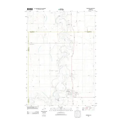
2013 Map of Winnebago
USGS Topo · Published 2013About this map
The Blue Earth River snakes through the center of this Faribault County landscape, its meandering path creating a sharp contrast with the rigid grid of rural roads and drainage infrastructure. This area, dominated by the city of Winnebago, reflects a century of agricultural adaptation. The extensive network of man-made waterways, including Judicial Ditch Number Twentyfour and County Ditch Number Twentythree, highlights the massive engineering efforts required to manage the prairie hydrology for farming.
Find a feature on this map
72 named features on this map. Tap any name to fly to it.
Don’t see what you’re looking for? This feature index may not catch every label — zoom into the map to look around manually.
Map Details
Editions of this 2013 Winnebago Map
This is the sole edition of this map. No revisions or reprints were ever made.
Other maps of this area

1954 · Fairmont
USGS Topo · 1:250,000

1958 · Fairmont
USGS Topo · 1:250,000

1967 · Truman SE
USGS Topo · 1:24,000

1967 · Winnebago
USGS Topo · 1:24,000

1967 · Willow Creek
USGS Topo · 1:24,000

1967 · Granada
USGS Topo · 1:24,000

1967 · Huntley
USGS Topo · 1:24,000
1967 · Amboy
USGS Topo · 1:24,000
1967 · Delavan
USGS Topo · 1:24,000
1967 · Sterling Center
USGS Topo · 1:24,000