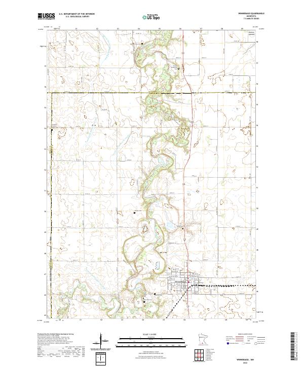
2022 Map of Winnebago
USGS Topo · Published 2022About this map
The Blue Earth River and its various tributaries, including the Blue Earth River Tri, meander through this agricultural landscape at the junction of Faribault, Martin, and Blue Earth counties. The town of Winnebago serves as the primary hub, showing a grid of streets such as Cleveland Ave W and Main St N centered around a local Po. This modern survey illustrates the intensive water management of the region, where natural drainage is supplemented by an extensive system of artificial channels including Judicial Ditch Number Twentyfour, County Ditch Number Twentythree, and Judicial Ditch Number Twentyfive.
Find a feature on this map
55 named features on this map. Tap any name to fly to it.
Don’t see what you’re looking for? This feature index may not catch every label — zoom into the map to look around manually.
Map Details
Editions of this 2022 Winnebago Map
This is the sole edition of this map. No revisions or reprints were ever made.
Other maps of this area

1954 · Fairmont
USGS Topo · 1:250,000

1958 · Fairmont
USGS Topo · 1:250,000

1967 · Truman SE
USGS Topo · 1:24,000

1967 · Winnebago
USGS Topo · 1:24,000

1967 · Willow Creek
USGS Topo · 1:24,000

1967 · Granada
USGS Topo · 1:24,000

1967 · Huntley
USGS Topo · 1:24,000
1967 · Amboy
USGS Topo · 1:24,000
1967 · Delavan
USGS Topo · 1:24,000
1967 · Sterling Center
USGS Topo · 1:24,000