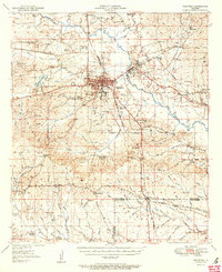
1951 Map of Winnfield
USGS Topo · Published 1951About this map
Winnfield serves as the industrial and transportation hub of the region, where a dense network of timber-related infrastructure meets a complex web of early twentieth-century rail lines. The Tremont and Gulf RR and Chicago Rock Island and Pacific RR converge near a large Creosote Plant and Quarry, illustrating the area's deep ties to the logging and resource extraction industries. The surrounding landscape within the Dugdemona Forest Boundary is defined by the winding course of the Dugdemona River and numerous small settlements like Atlanta and Joyce.
Find a feature on this map
97 named features on this map. Tap any name to fly to it.
Don’t see what you’re looking for? This feature index may not catch every label — zoom into the map to look around manually.
Map Details
Editions of this 1951 Winnfield Map
2 editions found

Other maps of this area

1932 · Colfax NE
USGS Topo · 1:31,680

1932 · Colfax NW
USGS Topo · 1:31,680

1935 · Verda
USGS Topo · 1:31,680

1936 · Colfax
USGS Topo · 1:62,500

1936 · Pollock
USGS Topo · 1:62,500

1937 · Montgomery
USGS Topo · 1:62,500

1941 · Pollock
USGS Topo · 1:62,500

1942 · Montgomery
USGS Topo · 1:62,500

1945 · Montgomery
USGS Topo · 1:62,500

1947 · Goldonna
USGS Topo · 1:62,500