
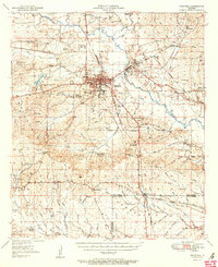
1951 Map of Winnfield
USGS Topo · Published 1951About this map
The Dugdemona River and the sprawling Kisatchie National Forest define the geography of this central Louisiana region during the mid-century. Industry is centered on Winnfield, where a Creosote Plant and nearby Quarry indicate the local economic reliance on timber and mineral extraction. The rail network is particularly dense for the era, with tracks of the Chicago Rock Island And Pacific, Tremont And Gulf, and Gulf And Mississippi converging at points like Menefee Junction. Scattered through the woodland are numerous rural landmarks essential for genealogical research, including the Old Pleasant Hill Cem, Sardis Ch, and the McCarty Sch No 1. The presence of several fire lookout towers, such as Sardis Lookout Tower, underscores the importance of the timber industry within the Dugdemona Forest Boundary.
Find a feature on this map
89 named features on this map. Tap any name to fly to it.
Don’t see what you’re looking for? This feature index may not catch every label — zoom into the map to look around manually.
Map Details
Editions of this 1951 Winnfield Map
2 editions found
Other maps of this area

1932 · Colfax NE
USGS Topo · 1:31,680

1932 · Colfax NW
USGS Topo · 1:31,680

1935 · Verda
USGS Topo · 1:31,680

1936 · Colfax
USGS Topo · 1:62,500

1936 · Pollock
USGS Topo · 1:62,500

1937 · Montgomery
USGS Topo · 1:62,500

1941 · Pollock
USGS Topo · 1:62,500

1942 · Montgomery
USGS Topo · 1:62,500

1945 · Montgomery
USGS Topo · 1:62,500

1947 · Goldonna
USGS Topo · 1:62,500