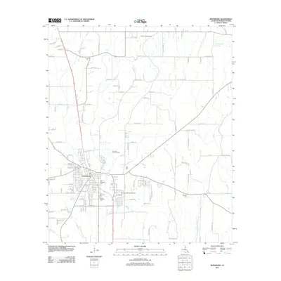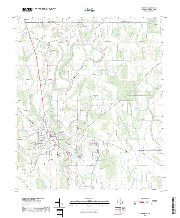
2024 Map of Winnsboro
USGS Topo · Published 2024About this map
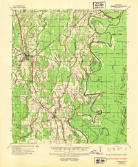
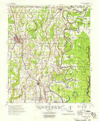
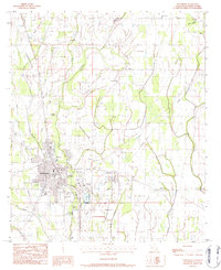
The Franklin Parish Courthouse serves as the focal point for the city of Winnsboro, where a dense network of streets gives way to the agricultural landscapes of the Louisiana delta. The settlement pattern is defined by its relation to the bayous and sloughs that drain the parish, including Stokes Bayou and Ash Slough. Numerous burial sites, such as Old Winnsboro Cem and Myrtle Memorial Cem, offer significant genealogical value for those tracing local family lineages. To the north, the smaller community of Baskin sits along the roadway toward Bulls Bayou. The landscape is a complex grid of section lines and rural routes like Baskin Crowville Rd and Courthouse Rd, reflecting a region deeply tied to its geography and civil administration. The Winnsboro Municipal Airport stands as a modern landmark on the southern edge of the municipal center.
Find a feature on this map
81 named features on this map. Tap any name to fly to it.
Don’t see what you’re looking for? This feature index may not catch every label — zoom into the map to look around manually.
Map Details
Editions of this 2024 Winnsboro Map
This is the sole edition of this map. No revisions or reprints were ever made.
Historical Maps of Winnsboro Through Time
8 maps found