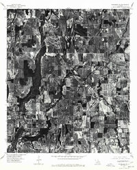
1976 Map of Winnsboro SW
USGS Topo · Published 1977About this map
Gilbert and the surrounding agricultural lands of Franklin Parish are captured here in a mid-1970s orthophotoquad, showing a landscape defined by geometric field patterns and riparian corridors. This specialized survey, produced by the Department of the Interior Geological Survey and the State of Louisiana, uses aerial photography to detail the exact layout of the countryside rather than traditional topographic lines. The village of Gilbert serves as a local hub along the rail line, while smaller settlements like Chase and Jigger anchor the outlying farming tracts. The winding course of Deer Creek cuts through the eastern portion of the map, its natural curves contrasting sharply with the straightened drainage ditches and structured property lines that characterize this part of the Mississippi Delta region.
Find a feature on this map
4 named features on this map. Tap any name to fly to it.
Don’t see what you’re looking for? This feature index may not catch every label — zoom into the map to look around manually.
Map Details
Editions of this 1976 Winnsboro SW Map
This is the sole edition of this map. No revisions or reprints were ever made.
Other maps of this area

1935 · Winnsboro
USGS Topo · 1:62,500

1939 · Fort Necessity
USGS Topo · 1:62,500

1941 · Sicily Island
USGS Topo · 1:62,500

1941 · Harrisonburg
USGS Topo · 1:62,500

1953 · Natchez
USGS Topo · 1:250,000

1955 · Jackson
USGS Topo · 1:250,000

1956 · Natchez
USGS Topo · 1:250,000

1957 · Sicily Island
USGS Topo · 1:62,500

1958 · Winnsboro
USGS Topo · 1:62,500

1958 · Fort Necessity
USGS Topo · 1:62,500