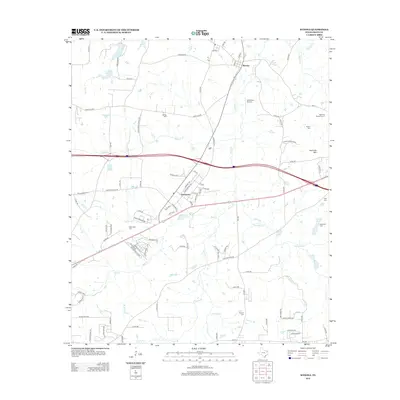
2012 Map of Winona
USGS Topo · Published 2012About this map
Winona and Owentown anchor this Smith County landscape, characterized by a complex network of creeks and small lakes in the early 21st century. The terrain is defined by the drainage of Harris Cr, Wiggins Cr, and Sunstroke Cr, which flow through a mix of wooded areas and rural residential developments. Genealogy researchers will find numerous family and community burial grounds, including Marsh Cem, McDougle Cem, and Seastrunk Cem.
Find a feature on this map
107 named features on this map. Tap any name to fly to it.
Don’t see what you’re looking for? This feature index may not catch every label — zoom into the map to look around manually.
Map Details
Editions of this 2012 Winona Map
This is the sole edition of this map. No revisions or reprints were ever made.
Other maps of this area

1938 · Winona
USGS Topo · 1:48,000

1943 · Winona
USGS Topo · 1:62,500

1948 · Tyler
USGS Topo · 1:62,500

1949 · Tyler
USGS Topo · 1:62,500

1956 · Tyler
USGS Topo · 1:250,000

1960 · Hawkins
USGS Topo · 1:24,000

1960 · Big Sandy
USGS Topo · 1:24,000

1960 · Crow
USGS Topo · 1:24,000

1966 · Hope Pond
USGS Topo · 1:24,000
1966 · Starrville
USGS Topo · 1:24,000