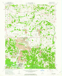
1961 Map of Winslow
USGS Topo · Published 1963About this map
The Patoka River winds through this Pike County landscape, which was characterized in the early 1960s by a mix of heavy industrial activity and forest conservation. Extensive Strip Mine operations dominate the central terrain, while the Algiers Winslow and Western and Southern railroads provide the logistical backbone for the region's coal and oil production. This survey captures a moment when smaller settlements like Campbelltown and Algiers remained distinct alongside the larger town of Winslow.
Find a feature on this map
45 named features on this map. Tap any name to fly to it.
Don’t see what you’re looking for? This feature index may not catch every label — zoom into the map to look around manually.
Map Details
Editions of this 1961 Winslow Map
Other maps of this area

1902 · Ditney
USGS Topo · 1:125,000

1903 · Velpen
USGS Topo · 1:62,500

1903 · Petersburg
USGS Topo · 1:62,500

1944 · Glendale
USGS Topo · 1:24,000

1944 · Monroe City
USGS Topo · 1:24,000

1945 · Sandy Hook
USGS Topo · 1:24,000

1956 · Vincennes
USGS Topo · 1:250,000

1957 · Vincennes
USGS Topo · 1:250,000

1958 · Vincennes
USGS Topo · 1:250,000
1958 · Monroe City
USGS Topo · 1:24,000