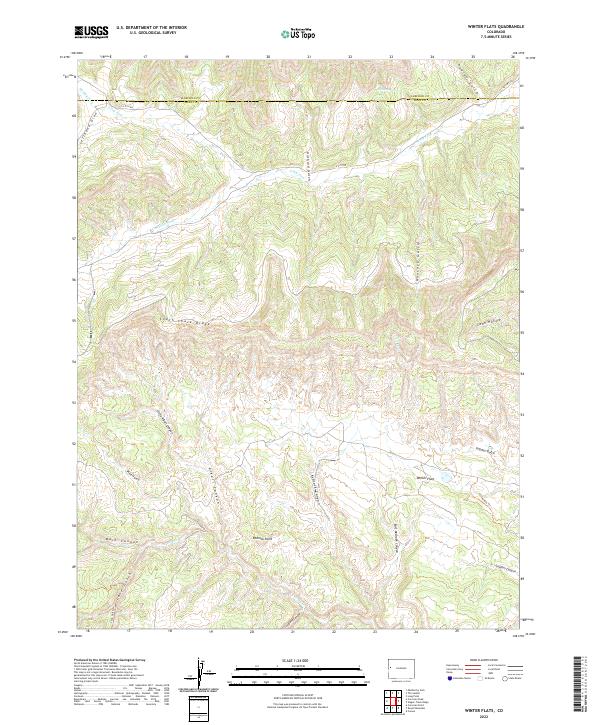
2022 Map of Winter Flats
USGS Topo · Published 2022About this map
South Shale Ridge forms a prominent topographic divide in this high-desert region of Western Colorado, separating the drainage systems of the north and south. The landscape is defined by a network of steep canyons and gulches, including Main Canyon, Alkali Canyon, and the intricate Redrock Canyon. Water sources are sparse but critical, marked by seasonal flows such as Jerry Cr, South Dry Fork, and the isolated Willow Spring. This 2022 survey documents a largely undeveloped terrain where human activity is limited to remote routes like CO Hwy 222 and the Lane Gulch Trl. The map illustrates the transition from the plateaus near Winter Flats to the broken ground of Redrock Point, reflecting a geography shaped by erosion and elevation changes along the county line.
Find a feature on this map
33 named features on this map. Tap any name to fly to it.
Don’t see what you’re looking for? This feature index may not catch every label — zoom into the map to look around manually.
Map Details
Editions of this 2022 Winter Flats Map
This is the sole edition of this map. No revisions or reprints were ever made.
Other maps of this area

1929 · Roan Creek
USGS Topo · 1:62,500

1955 · Cameo
USGS Topo · 1:24,000

1956 · Grand Junction
USGS Topo · 1:250,000

1959 · Grand Junction
USGS Topo · 1:250,000

1960 · Grand Junction
USGS Topo · 1:250,000

1962 · Grand Junction
USGS Topo · 1:250,000
1962 · Round Mountain
USGS Topo · 1:24,000

1962 · Corcoran Point
USGS Topo · 1:24,000

1964 · Grand Junction
USGS Topo · 1:250,000

1965 · Grand Junction
USGS Topo · 1:250,000