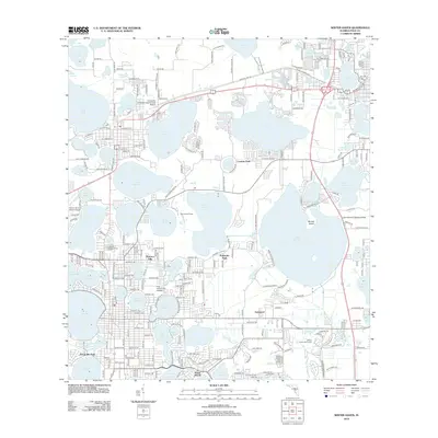
2012 Map of Winter Haven
USGS Topo · Published 2012About this map
Florence Villa and several neighboring residential developments define the mid-county landscape of Central Florida in the early 21st century. This region is characterized by an immense concentration of freshwater bodies, including the large Lake Hamilton and Lake Henry, interspersed with established neighborhoods like Poinsettia Park and Eastwood. The map reflects a community deeply integrated with its water resources, featuring specialized transportation hubs such as the Lake Hamilton Seaplane Base alongside the more traditional Winter Haven's Gilbert Airport.
Find a feature on this map
142 named features on this map. Tap any name to fly to it.
Don’t see what you’re looking for? This feature index may not catch every label — zoom into the map to look around manually.
Map Details
Editions of this 2012 Winter Haven Map
This is the sole edition of this map. No revisions or reprints were ever made.
Other maps of this area

1944 · Polk City
USGS Topo · 1:31,680

1944 · Auburndale
USGS Topo · 1:31,680

1949 · Bartow
USGS Topo · 1:24,000

1950 · Bartow
USGS Topo · 1:24,000

1952 · Lake Wales
USGS Topo · 1:24,000

1953 · Dundee
USGS Topo · 1:24,000

1953 · Davenport
USGS Topo · 1:24,000

1955 · Eloise
USGS Topo · 1:24,000

1955 · Orlando
USGS Topo · 1:250,000

1956 · Fort Pierce
USGS Topo · 1:250,000