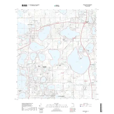
2018 Map of Winter Haven
USGS Topo · Published 2018About this map
Winter Haven serves as the focal point of this Lakeland-area survey, revealing a landscape defined by an intricate network of interconnected freshwater lakes. The transition from the residential street grids of Lake Alfred and Haines City into the lakefront communities of Lucerne Park and Florence Villa illustrates the region's mid-century expansion and reliance on citrus and tourism. The map detail highlights the CSX Transportation rail line cutting through the terrain, historically vital for moving Florida's phosphate and citrus harvests.
Find a feature on this map
333 named features on this map. Tap any name to fly to it.
Don’t see what you’re looking for? This feature index may not catch every label — zoom into the map to look around manually.
Map Details
Editions of this 2018 Winter Haven Map
This is the sole edition of this map. No revisions or reprints were ever made.
Other maps of this area

1944 · Polk City
USGS Topo · 1:31,680

1944 · Auburndale
USGS Topo · 1:31,680

1949 · Bartow
USGS Topo · 1:24,000

1950 · Bartow
USGS Topo · 1:24,000

1952 · Lake Wales
USGS Topo · 1:24,000

1953 · Dundee
USGS Topo · 1:24,000

1953 · Davenport
USGS Topo · 1:24,000

1955 · Eloise
USGS Topo · 1:24,000

1955 · Orlando
USGS Topo · 1:250,000

1956 · Fort Pierce
USGS Topo · 1:250,000