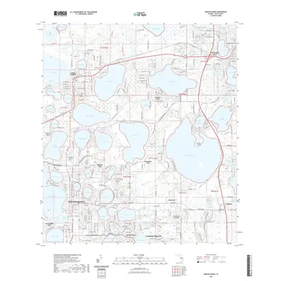
2021 Map of Winter Haven
USGS Topo · Published 2021About this map
The Lake Wales Ridge dominates the eastern edge of this 2021 landscape, a prominent geological feature in a region defined by its dense network of interconnected waters. This map details the sprawling growth of Winter Haven and Lake Alfred, where residential neighborhoods and infrastructure like the Winter Haven Regional Airport have integrated into the lakefronts. The survey captures established local institutions including Polk State College and the Saint Matthew Catholic Church Columbarium, alongside older burial grounds such as Oak Grove Cem and Oakland Cem.
Find a feature on this map
189 named features on this map. Tap any name to fly to it.
Don’t see what you’re looking for? This feature index may not catch every label — zoom into the map to look around manually.
Map Details
Editions of this 2021 Winter Haven Map
This is the sole edition of this map. No revisions or reprints were ever made.
Other maps of this area

1944 · Polk City
USGS Topo · 1:31,680

1944 · Auburndale
USGS Topo · 1:31,680

1949 · Bartow
USGS Topo · 1:24,000

1950 · Bartow
USGS Topo · 1:24,000

1952 · Lake Wales
USGS Topo · 1:24,000

1953 · Dundee
USGS Topo · 1:24,000

1953 · Davenport
USGS Topo · 1:24,000

1955 · Eloise
USGS Topo · 1:24,000

1955 · Orlando
USGS Topo · 1:250,000

1956 · Fort Pierce
USGS Topo · 1:250,000