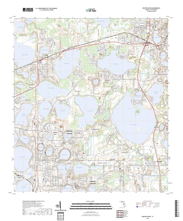
2024 Map of Winter Haven
USGS Topo · Published 2024About this map
Winter Haven and its surrounding citrus-belt neighbors anchor this recent survey of Polk County’s lake-dense interior. The landscape is defined by an intricate network of interconnected waterways, where the Lake Wales Ridge provides subtle elevation changes amidst the countless basins of Lake Hamilton, Lake Conine, and Lake Rochelle. The region’s residential and educational growth is centered around Polk State College and the distinct neighborhoods of Florence Villa and Lucerne Park, while industrial and transit corridors follow the path of Railroad Ave and the historic Old Dixie Hwy. Local heritage is preserved at sites like Oaklawn Cem and the Saint Matthew Catholic Church Columbarium, set against the recreational backdrop of the world-famous Cypress Gardens area.
Find a feature on this map
199 named features on this map. Tap any name to fly to it.
Don’t see what you’re looking for? This feature index may not catch every label — zoom into the map to look around manually.
Map Details
Editions of this 2024 Winter Haven Map
This is the sole edition of this map. No revisions or reprints were ever made.
Other maps of this area

1944 · Polk City
USGS Topo · 1:31,680

1944 · Auburndale
USGS Topo · 1:31,680

1949 · Bartow
USGS Topo · 1:24,000

1950 · Bartow
USGS Topo · 1:24,000

1952 · Lake Wales
USGS Topo · 1:24,000

1953 · Dundee
USGS Topo · 1:24,000

1953 · Davenport
USGS Topo · 1:24,000

1955 · Eloise
USGS Topo · 1:24,000

1955 · Orlando
USGS Topo · 1:250,000

1956 · Fort Pierce
USGS Topo · 1:250,000