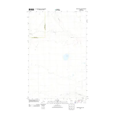
2013 Map of Winter Road Lake
USGS Topo · Published 2013About this map
Winter Road Lake sits at the center of this remote landscape along the border of Roseau and Lake of the Woods counties. The 2013 survey illustrates a terrain defined by subtle elevation changes and an intermittent network of timber and access routes. Primarily an area of wetlands and forest, the map documents the administrative boundary between Roseau and Lake of the Woods counties as it bisects this northern Minnesota wilderness. Movement through the area is defined by primitive forest passages such as Cole Forest Rd and Carps Trl, which connect the scattered water bodies and clearings. Further south, Nelson Forest Rd and 19tn St SW provide limited access to the lower portions of the quadrangle. This map is a record of the natural hydrography and forestry infrastructure in a region where the landscape is shaped more by water and woods than by permanent settlement.
Find a feature on this map
7 named features on this map. Tap any name to fly to it.
Don’t see what you’re looking for? This feature index may not catch every label — zoom into the map to look around manually.
Map Details
Editions of this 2013 Winter Road Lake Map
This is the sole edition of this map. No revisions or reprints were ever made.
Other maps of this area

1918 · Winterroad
USGS Topo · 1:62,500

1918 · Roosevelt
USGS Topo · 1:62,500

1918 · Williams
USGS Topo · 1:62,500

1919 · Peppermint Creek
USGS Topo · 1:62,500

1943 · Peppermint Creek
USGS Topo · 1:62,500

1943 · Roosevelt
USGS Topo · 1:62,500

1954 · Roseau
USGS Topo · 1:250,000

1957 · Roseau
USGS Topo · 1:250,000

1958 · Roseau
USGS Topo · 1:250,000

1967 · Williams
USGS Topo · 1:24,000