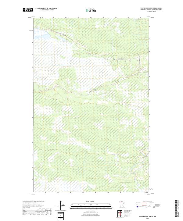
2022 Map of Winter Road Lake SE
USGS Topo · Published 2022About this map
Hydrological patterns and remote forest tracks define this portion of Lake of the Woods County, where the Br Rapid River and Meadow Br drain a landscape dominated by extensive wetlands. The region's transport network is characterized by established forest routes and trails, most notably the Faunce Butterfield Forest Rd which cuts diagonally across the northern sections. Other local passages, such as Hogback Obrien Rd Sw and the Spina Trl, provide access to the interior of this heavily forested and marshy territory. This survey illustrates the intricate drainage systems and the sparse, utilitarian road network essential for forestry and land management in northern Minnesota.
Find a feature on this map
9 named features on this map. Tap any name to fly to it.
Don’t see what you’re looking for? This feature index may not catch every label — zoom into the map to look around manually.
Map Details
Editions of this 2022 Winter Road Lake SE Map
This is the sole edition of this map. No revisions or reprints were ever made.
Other maps of this area

1918 · Winterroad
USGS Topo · 1:62,500

1918 · F
USGS Topo · 1:62,500

1919 · Peppermint Creek
USGS Topo · 1:62,500

1919 · G
USGS Topo · 1:62,500

1943 · Peppermint Creek
USGS Topo · 1:62,500

1954 · Roseau
USGS Topo · 1:250,000

1957 · Roseau
USGS Topo · 1:250,000

1958 · Roseau
USGS Topo · 1:250,000
1968 · Graceton NW
USGS Topo · 1:24,000
1968 · Winter Road Lake
USGS Topo · 1:24,000